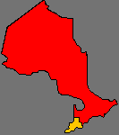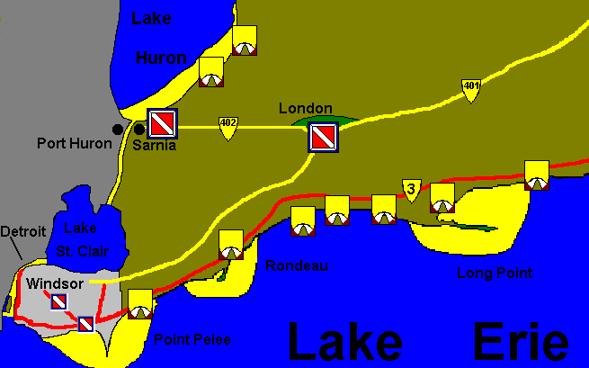
This is the southern most region in Canada. With a latitude of Northern California this area has the warmest diving available, and the longest season. From the developed St. Clair and Detroit River system to the deserted coastline of Lake Erie there are several weeks worth of diving available on numerous shipwrecks.
The Lake Erie coastline is very flat on the western rim, rising to bluffs and rolling sand dunes at Long Point and ending in the colossal Niagara gorge where it pours into Lake Ontario. The region is the flattest in Ontario, but is rolling in places and cut by many rivers.
The summer heat provides the fuel for some of Canada's most impressive Thunderstorm activity especially in the Windsor to London corridor. Be careful if you venture out into the open lakes; both Erie and Huron are big and dangerous.
Several rivers are routinely dove, and several quarries in the region allow divers. The rivers are usually characterized as high current or low visibility and are generally not suitable for novice divers. The quarries provide very protected, shallow safe diving.
The visibility ranges from excellent to zero. Lake Huron is the clearest diving in the province and Lake Erie, because it is shallow, and silt filled is generally much lower visibility. However, the invasion of Zebra Mussels in recent years has filtered out so much of the silt in Lake Erie that its visibility is often as good as it is in Lake Huron.
The heavy population in the Western area makes boaters the single greatest hazard the diver will face, and a dive flag is absolutely an essential item in this area.

This is a contact list for the parks. The "Camp Sites" column lists the total available for the park. The "Pull Through" list indicates the fraction that can accomodate trailers. The reservation phone numbers may indicate the regional office in some cases.
| Park | Camp Sites | Pull Through | Park Phone | Reservations |
| Pinery | 1000 | 126 | (519) 243-2220 | (519) 243-3099 |
| Ipperwash | 266 | 112 | (519) 243-2220 | (519) 243-3099 |
| Point Pelee National | na | na | (519) 326-3204 | na |
| Wheatley | 210 | 210 | (519) 825-4659 | (519) 354-7340 |
| Rondeau | 226 | 150 | (519) 674-5404 | (519) 354-7340 |
| John E. Pearce | na | na | na | na |
| Port Bruce | na | na | (519) 773-9241 | na |
| Port Burwell | 232 | ? | (519) 874-4691 | (416) 314-1717 |
| Long Point | 265 | 100 | (519) 586-2133 | (519) 426-7650 |
| Turkey Point | 195 | 30 | (519) 426-3239 | (519) 426-7650 |
These descriptions are linked to the park icons on the map. Clicking on one will bring you to the appropriate park description.
A favourite spot for summer parties. This park is located near the community of Grand Bend It is somewhat out of the way for diving, except for the Kettle Point site.
Currently there are ownership disputes regarding this park. It is not particularly near any diving sites.
This park provides access to the only shore dive wreck in the region. It is Canada's most southern point and is definitely worth the visit. There is no camping in the park, but there are numerous places to chose from around the area. The park is a must visit for several reasons. This lance-like formation juts out into Lake Erie and has impaled a staggering variety of ships on her shoals. The wreck of the Conemaugh lies just off the tip, it struck the point so hard that her propeller blades were snapped off.
Several creeks provide canoeing within the park, and plenty of beach access is available on the lake. Quiet and out of the way.
The second of the three sandspits of Ontario contains the largest remaining stand of Ontario's hardwood forest. Over 200 campgrounds and 12 kilometres of beach give you plenty of room. Easy access to the Rondeau wrecks from this area.
No camping is available here, but you can see the sand and clay bluffs that run along a part of the lake shore.
A neighbouring park to Pearce, no camping is available.
The nearest park outside Long Point, it features woodlands, meadows, wetlands and dunes. over 200 campsites, and comfort stations with showers are available.
Plenty of camping and comfort stations here. The sand and gravel beaches and wetlands make it excellent for bird watching. It is the longest sandspit in Ontario and hides dozens of sunken vessels off her sandy shores.
Located along lake Erie bluffs, there is almost 2km of beaches, 195 campsites and comfort stations.
SITE INDEX:
[MAIN MENU] [MAP INDEX] [QUICK INDEX] [American Visitors] [World Wide Visitors] [Canadian Visitors] [Help]© M. Colautti 1996-1999, 2000</>
Visit the new national site CanExplore
ontario scuba diving region 1 south western ontario ontario scuba diving region 1 south western ontario ontario scuba diving region 1 south western ontario ontario scuba diving region 1 south western ontario ontario scuba diving region 1 south western ontario ontario scuba diving region 1 south western ontario ontario scuba diving region 1 south western ontario